Sinla Pass Trek: A Journey Through Ancient Trails, Sacred Valleys, and the High Himalayas
The Himalayas are filled with some of the most beautiful and adventurous high-altitude treks in the world. Every trail has its own stories of gods, ancient travelers, local tribes, and breathtaking natural scenery. One such amazing trail is the Sinla Pass Trek, a tough but unforgettable journey located in the remote mountains of Pithoragarh district in Uttarakhand. Standing at a massive height of 5,495 meters (18,300 feet), Sinla Pass is like a natural doorway that connects the peaceful Darma Valley with the sacred Adi Kailash–Kutti Yankti Valley.
For hundreds of years, this snow-covered pass was an important trading route for the Bhotiya community, the original mountain people of this region. They travelled across Sinla Pass carrying wool, herbs, salt, and other goods to trade with Tibet. Even today, the pass remains covered with snow throughout the year, quietly holding memories of ancient trade caravans, monks, pilgrims, and explorers who once crossed its steep and icy slopes.
Although the area is remote and difficult to reach, the natural beauty here is unmatched. The trek takes you through tall snowy peaks, shining glaciers, green meadows, traditional villages built of stone and wood, and deep valleys filled with rivers and streams. The colourful culture of the local people their food, traditional clothes, festivals, and old stories adds a special charm to this journey.
What makes this trek even more special is its spiritual importance. The region around the pass is closely connected to Adi Kailash, which is believed to be a sacred abode of Lord Shiva. Trekkers also come across holy lakes, ancient temples, and prayer stones placed along the trail by villagers and pilgrims. These sacred spots bring a sense of peace and connect trekkers to the deep spiritual energy of the mountains.
Sinla Pass Trek is not only a physical adventure—it is a journey through the living history and culture of the Kumaon Himalayas. Walking through old Bhotiya villages like Kutti, Gunji, Napalchu, and Dantu, trekkers get to see traditional wooden houses, learn about ancient migration routes, listen to local folk tales, and understand how the mountain people survived in harsh climates long before roads were built.
This blog takes you through everything about the Sinla Pass Trek—from its history and geographical meaning to the daily itinerary, challenges, and highlights. It is written to give trekkers, researchers, travel enthusiasts, and spiritual seekers a complete understanding of this lesser-known yet remarkable Himalayan journey.
Understanding Sinla Pass: Geography, History, and Significance
Sinla Pass is located in the far-eastern part of the Kumaon Himalayas, very close to the borders of Nepal and Tibet. Standing at a high altitude of 5,495 meters (18,300 feet), it is one of the toughest and highest mountains passes in Uttarakhand that trekkers can reach.
The pass works like a natural doorway between two beautiful and culturally rich valleys:
- Bedang in the Darma Valley
- Jolingkong in the Adi Kailash / Kutti Yankti Valley
These areas fall under the Byans–Johar–Darma tribal region, a remote zone famous for its:
- Majestic mountains
- Crystal-clear glacial rivers
- Alpine meadows and forests
- Unique Himalayan culture that has existed for hundreds of years
What the Land Looks Like
The geography around Sinla Pass is wild and dramatic. You will see:
- Steep rocky slopes rising sharply upward
- Narrow knife-edge ridges where only one person can walk at a time
- Paths filled with boulders and moraine
- Snowfields that remain for most of the year
- Hanging glaciers clinging to the surrounding peaks
Snow is common even in summer, which gives the trek an expedition-like experience. There are almost no permanent settlements near the pass, making the place feel completely untouched and peaceful.
Local Significance and Cultural Importance
Sinla Pass is not just a geographical landmark—it holds deep historical and cultural value for the people living in this high Himalayan belt.
Ancient Trade Route of the Bhotiyas
For centuries, the pass was used by the Bhotiyas, the original inhabitants of the Johar, Darma, and Byans valleys.
They travelled across Sinla Pass with: Wool, Herbs, Salt, Grains, Handcrafted goods
These trade journeys connected India and Tibet, forming one of the earliest Himalayan trade networks. Even today, many trekking trails follow these old caravan routes.
Connection to Adi Kailash Region
The pass lies close to the holy land of Adi Kailash, believed to be the earthly home of Lord Shiva. Because of this, the entire area is viewed with great respect by locals.
Pilgrims visiting: Adi Kailash Peak, Gauri Kund, Jolingkong Lake
pass through these valleys and experience the same landscapes that the ancient traders and sages once walked.
Home to Indigenous Himalayan Communities
The surrounding villages such as: Duktu, Dantu, Gunji, Kutti, Nabi, Son, Sela
are among the most remote settlements in India. Their culture includes:
- Traditional stone-and-wood houses
- Wool weaving (Pashmina and local wool)
- Festivals linked to nature and mountain spirits
- A deep respect for the mountains, rivers, and wildlife
Locals speak languages such as Byansi, Rung, Darma, and Kumaoni, each carrying centuries of oral history.
Rich Natural Heritage
The Sinla Pass area is part of a fragile high-altitude ecosystem. Trekkers often see:
- Blue sheep (Bharal)
- Himalayan ibex
- Snow pigeons
- Lammergeiers (a large vulture)
- Rare medicinal plants like Kutki, Atis, and Jatamansi
The rivers here form the origins of the Kali River, also called Sharda, which eventually becomes the border between India and Nepal.
Why This Geography Matters for Trekkers
Because of its height and remoteness, Sinla Pass offers:
- A pure wilderness experience
- A chance to walk on ancient Himalayan trade routes
- Stunning views of peaks like Adi Kailash, Api, Nampa, and Panchachuli
- Rare cultural encounters with communities that still preserve age-old Himalayan traditions
It is a place where nature, culture, and history come together, making the journey more meaningful than just a high-altitude trek.
Historical Importance: The Ancient Bhotiya Trade Route
Many years ago, before there were strict borders between India, Nepal, and Tibet, the high Himalayan valleys were closely connected through old trade routes. People travelled freely from one valley to another, sharing goods, culture, and traditions.
The Bhotiya community, the original people of the Darma, Byans, and Johar valleys, played a very important role in this trade. They were skilled:
- Pastoralists (raising animals like sheep, goats, and yaks)
- Traders
- Explorers of the high mountains
The Bhotiyas carried items such as:
- Salt from Tibet
- Wool and pashmina
- Medicinal herbs
- Handwoven carpets and clothes
- Grains, spices, and metal tools
These goods travelled across some of the most difficult Himalayan passes—one of the most important being Sinla Pass.
Sinla Pass: A Lifeline of the Old Himalayan World
Even though Sinla Pass is extremely high, snowy, and risky, it was a major trading gateway. The Bhotiya caravans moved in long lines, bringing their animals loaded with goods.
The traditional route looked like this:
Darma Valley → Bedang → Sinla Pass → Jolingkong → Tibet
This trail was the main link between two powerful cultures:
- The Himalayan civilization of Kumaon
- The trading towns of Tibetan plateau
Every stone, meadow, and campsite on this route has stories of:
- Traders
- Nomads
- Buddhist monks
- Pilgrims
- Local shepherds
who walked here for generations.
Life of the Bhotiya Traders: Stories from the Past
Locals describe how trading groups would start their journey in early summer when the snow melted slightly. They travelled with:
- Hundreds of sheep and goats
- Strong yaks that carried heavy loads
- Traditional wool tents for night stays
- Firewood bundles tied to their backs
- Dried meat, barley flour, and butter tea for long days
Crossing Sinla Pass was a test of courage.
Storms could appear suddenly.
Snow could bury the trail.
But the Bhotiyas knew the mountains like the lines on their palms.
Their knowledge of:
- Weather
- Glaciers
- High-altitude survival
is still respected today.
Cultural Footprints Still Alive Today
Trade through Sinla Pass stopped after the 1962 Indo-China War, when the borders were closed.
But the memories and cultural influences remain strong.
You can still see them in:
- Architecture of stone houses in villages like Duktu, Dantu, Gunji, Nabi, and Kutti
- Wool weaving traditions like pashmina shawls, carpets, and jackets
- Local food, including tsampa (roasted barley flour), Tibetan bread, and salt tea
- Festivals and rituals, many of which are influenced by Buddhism and nature worship
- Sacred places, especially near Adi Kailash and Jolingkong Lake
Walking this trail today is like walking through a living museum of mountain history.
What It Means for Trekkers Today
When trekkers climb towards Sinla Pass now, they are not just going on a physical adventure—they are recreating an ancient journey.
Every step follows the same path where:
- Traders led their caravans
- Families moved between summer and winter homes
- Pilgrims walked towards sacred lakes
- Ancient exchanges took place
This makes the Sinla Pass trek not only beautiful but also deeply meaningful.
It connects you to:
- The cultural heartbeat of the Bhotiyas
- The forgotten trails of the Himalayas
- The shared history of India and Tibet
Spiritual Relevance: Gateway to Adi Kailash -
Sinla Pass is not only a high Himalayan route it is also a spiritual doorway. As soon as you cross the pass, you enter the sacred region of Adi Kailash, a mountain that holds great importance in Hindu belief. Adi Kailash is often called “Chhota Kailash”, because it is considered a symbolic form of Mount Kailash in Tibet, the heavenly home of Lord Shiva.
For many pilgrims, travellers, and local villagers, this entire valley is a place of deep faith. The air, the mountains, the rivers, and even the old trails are believed to carry the presence of divine energy.
Sacred Places Along the Route
As trekkers continue from Sinla Pass toward the Adi Kailash–Kutti Yankti Valley, they pass several holy sites:
- Parwati Sarovar
A calm and crystal-clear sacred lake, believed to be blessed by Goddess Parvati.
Many visitors stop here for prayer, meditation, or simply to enjoy the peaceful surroundings.
- Kuti Village
This ancient village is linked with the story of Ravana’s penance.
According to local belief, Ravana performed deep devotion to Lord Shiva in this region to gain spiritual powers. The village still carries signs of old mythology, traditional houses, prayer stones, and a quiet spiritual atmosphere.
- Sacred Meadows, Temples, and Villages
The valley is filled with small temples, prayer spots, and meadows where locals perform rituals during special festivals.
Traditional Bhotiya villages like Kuthi, Gunji, and Nabi consider these mountains as living deities. Every trail, stream, and peak has a story of gods, ancestors, or mythic events.
Where Faith Meets Wilderness
The beauty of the Sinla Pass trek lies in how nature and spirituality come together.
Trekkers walk through:
- High mountains covered with snow
- Peaceful green meadows
- Silent lakes
- Ancient villages
- Old temples decorated with prayer flags
Along with breathtaking natural scenery, travelers feel the strong mountain faith that local people have followed for centuries.
A Journey of Inner Connection
Crossing Sinla Pass and entering the Adi Kailash region often feels like more than just trekking.
Many trekkers describe it as:
- A peaceful experience
- A moment of self-reflection
- A chance to connect with ancient stories and divine energy
- A walk through a sacred landscape untouched by time
The combination of mythology, culture, spirituality, and raw Himalayan beauty makes this journey truly unique.
Why Trek to Sinla Pass?
The Sinla Pass Trek is not like regular, popular Himalayan treks. It is far from crowded tourist routes, and that is what makes it special. The beauty of Sinla lies in its raw nature, silence, ancient culture, and true Himalayan toughness. This trek attracts people who want to experience the mountains in their purest form—without noise, without roads, and without modern disturbances.
Walking here feels like stepping back in time. You move through old Bhotiya villages, ancient trade paths, and sacred valleys that have remained unchanged for centuries. The connection between nature, history, and culture makes the Sinla Pass a once-in-a-lifetime experience.
A True High-Altitude Challenge
With an altitude of 18,300 feet, Sinla Pass is one of the highest trekking passes accessible in Uttarakhand. Reaching the top is not easy—it requires strong fitness, determination, and the ability to stay calm in tough Himalayan conditions.
The climb from Jolingkong to Sinla Pass is known for its challenging terrain. Trekkers face:
- Steep Ascents
The trail rises sharply from the very beginning. At this height, the thin air makes every step feel heavier, testing stamina and breathing.
- Loose Boulders and Rocky Paths
The route has large rocks and sliding stones. Trekkers must move carefully, especially when the surface becomes unstable.
- Glacier Sections
Parts of the trail pass over snow or glacier-like patches. Early morning is often the safest time to cross before the snow becomes soft.
- 4–5 Hours of Continuous Vertical Climbing
The final push to the pass is the toughest. Climbers often need to use both hands and feet while climbing over ridges and rock walls.

Why This Challenge Is Worth It
Despite the difficulty, this climb gives trekkers the feeling of being part of a real Himalayan expedition. The terrain is wild and untouched, the silence is deeper, and the views—especially of Adi Kailash, surrounding glaciers, and high peaks—are unforgettable.
Local Bhotiya people say that climbing Sinla Pass is like “taking blessings from the mountain gods” because the effort, purity of the route, and the altitude demand respect and devotion.
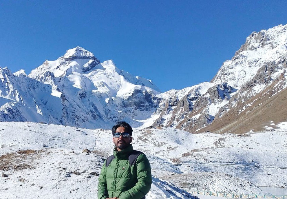
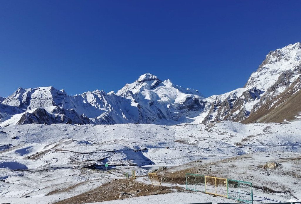
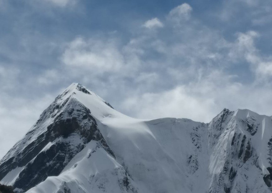
Spectacular View of Adi Kailash
One of the biggest rewards of the Sinla Pass Trek is the incredible view of Adi Kailash, one of the most sacred and beautiful mountains in the Himalayas. As trekkers climb higher towards Sinla Pass, the world around them begins to open up. On clear mornings, the scenery looks magical—wide, shining snowfields, tall ridgelines, and the mighty peak of Adi Kailash standing proudly in the distance.
From these high ridges, trekkers get to see:
- Adi Kailash Peak
This holy mountain, also known as Chhota Kailash, appears in a perfect pyramid shape, much like Mount Kailash in Tibet. Its snow-covered face glows golden during sunrise and silver-white during afternoons. Local villagers believe the mountain is a direct symbol of Lord Shiva, so seeing it from such height feels spiritually uplifting.
- Surrounding Himalayan Ranges
The region around Sinla Pass is surrounded by many unnamed and unexplored Himalayan peaks. The long chains of mountains create a dramatic skyline—one that is rarely seen in other treks. The silence and the vast open spaces make the views even more powerful.
- Snow-Covered Cliffs and Glaciers
The trail often passes close to icy cliffs, hanging glaciers, and deep valleys filled with snow. The combination of rugged terrain and shining ice formations gives trekkers a true sense of being in a high Himalayan expedition zone.
Why These Views Are So Special
What makes these views unforgettable is the remoteness of the region.
Very few people trek here, and there are no commercial crowds. Every mountain, every glacier, and every valley feels untouched and pure.
Local Bhotiya elders often say:
“Those who see Adi Kailash from Sinla Pass receive blessings for their entire life.”
For trekkers, this moment becomes the emotional and spiritual highlight of the journey—one that stays in memory long after the expedition is over.
Wildlife and Flora
The Sinla Pass trek is not only about high mountains and ancient trade routes—it is also a paradise for nature lovers. As the trail moves through forests, meadows, and rocky highlands, trekkers get to see a wide variety of plants and animals that are found only in the Himalayan region.
Rich Himalayan Vegetation
Along the route, trekkers walk through landscapes filled with:
- Wildflowers
During summer, the meadows burst into color with tiny alpine flowers. These flowers grow close to the ground and survive strong winds and cold temperatures. Their bright colors make the valleys look like natural carpets.
- Ferns
The lower forests near villages like Gala, Sirkha, and Gunji have tall, beautiful ferns. These plants love the cool, moist climate of these valleys and add a fresh green look to the trail.
- High-Altitude Shrubs
As you go higher, trees disappear and the landscape becomes open and rocky. Here, hardy shrubs like dwarf junipers and rhododendrons grow in small patches. These shrubs are important for local wildlife, providing food and shelter in tough climates.
- Rare Himalayan Herbs
The region is home to several medicinal herbs used by local Bhotiya communities for generations. Many herbs grow only at specific altitudes and are known for their healing properties. Villagers treat these plants with respect, seeing them as gifts of the mountains.
Unique Himalayan Wildlife
Trekkers who move quietly may spot some interesting animals along the way:
- Musk Deer
A shy and rare animal often found in forested slopes. Their graceful movement makes them a treat to watch.
- Bharal (Blue Sheep)
Commonly seen on high cliffs and rocky slopes. Their blue-grey coat blends perfectly with the mountain rocks, making them difficult to spot.
- Himalayan Birds
Colorful birds like monal, snow partridge, Himalayan griffon, and lammergeier glide over the valleys. Their presence adds life to the silent mountains.
- Signs of Snow Leopards
While it is extremely rare to see a snow leopard directly, trekkers may notice paw marks or scratch signs on rocks. These majestic predators roam the upper valleys and are an important part of the region’s ecosystem.
Local Significance of the Natural World
For the Bhotiya communities living in this region, the forests, flowers, and animals are deeply connected to their traditions. Many plants are used in traditional medicine, while animals like bharal and musk deer appear in local folk stories. The people believe that protecting these lands keeps the blessings of the mountains alive.
A Rare, Unexplored Route
The Sinla Pass Trek is truly special because it is still offbeat and untouched. Unlike well-known Himalayan treks such as Roopkund, Valley of Flowers, or Kedarkantha—where hundreds of trekkers walk every season—Sinla Pass remains quiet, isolated, and far from the usual trekking crowds.
A Trail That Few People Experience
Very few trekkers visit this region each year. This gives the route a rare feeling of privacy and adventure. When you walk on these paths, it often feels like the mountains belong only to you. The silence, the clean air, and the raw landscape create an experience that is almost impossible to find on commercial trails.
Nature in Its Purest Form
Because the region is not disturbed by large groups or tourism, everything remains natural and untouched:
- Meadows are fresh and unspoiled
- Villages still follow ancient customs
- Wildlife moves freely
- The mountains retain their wild, original beauty
This gives the trek a strong expedition-like atmosphere—something that experienced trekkers love.
Deep Cultural Isolation
The remoteness of the trail has helped preserve the traditional lifestyle of the Bhotiya community. Their wooden houses, old temples, traditional dress, and seasonal migration patterns have remained unchanged for generations. Trekkers get a chance to see this authentic mountain culture, which is rarely visible on popular trekking routes.
A True Himalayan Wilderness
Where most commercial treks have well-defined trails, guides at every corner, and established campsites, Sinla Pass offers a very different experience:
- No marked trails
- Limited human presence
- Pure wilderness
- High-altitude challenges
- Ancient pathways used only by locals and shepherds
This makes the journey feel like a real exploration—a chance to discover the Himalayas in their original, untouched form.
Trek Highlights at a Glance
The Sinla Pass Trek is one of the most exciting and culturally rich journeys in the Kumaon Himalayas. Before diving deeper into the route and details, here is a simple overview of what makes this trek truly special:
- Maximum Altitude:
5,495 meters (18,300 feet)
This height places Sinla Pass among the highest trekking passes in Uttarakhand. The thin air, snowfields, and steep climbs make the summit day a real adventure.
- Region:
Pithoragarh District, Uttarakhand
This remote Himalayan district is known for sacred mountains, ancient villages, rare wildlife, and untouched landscapes. It is part of the Darma–Byans–Johar cultural belt.
- Difficulty Level:
Difficult / Expedition Level
This is not a beginner’s trek. The rugged terrain, steep ascents, and high altitude give it an expedition-like feel.
- Pass Connects:
Darma Valley ↔ Adi Kailash / Kutti Yankti Valley
Sinla Pass acts as a natural bridge between two culturally rich and beautiful valleys. Trekkers walk through old Bhotiya villages, glacial valleys, and historic trade routes once connected to Tibet.
- Best Time to Trek:
May–June and September–October
These months offer stable weather, clear skies, and safe trail conditions. Snow remains on the pass throughout the year, but these seasons make the climb manageable.
- Duration:
9 Days (Kathgodam to Kathgodam)
The full journey includes travel from the plains to the mountains, acclimatization, and the trek through valleys, meadows, glaciers, and high passes.
Core Attractions of the Sinla Pass Trek
- Sinla Pass Summit
The highest point of the trek. Reaching this pass feels like stepping onto the roof of the Himalayas. The views, silence, and sense of achievement are unmatched.
- Jolingkong Lake
A clean, peaceful, high-altitude lake near Adi Kailash. This place has strong spiritual value and is known for its stunning reflections of surrounding peaks.
- Adi Kailash Views
One of the major highlights. Seeing the sacred Adi Kailash peak from the ridges gives trekkers a feeling of divine connection.
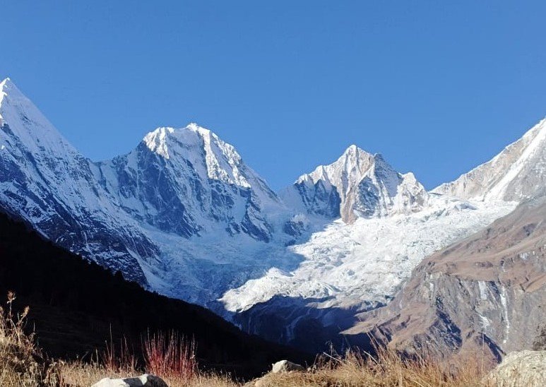
- Panchachuli Base Camp
A majestic spot offering close views of the famous Panchachuli peaks. The meadows here are wide, calm, and incredibly scenic.
- High-Altitude Villages
Villages like Kuthi, Gunji, and Bedang show the true lifestyle of the Bhotiya community. Their stone houses, ancient temples, and traditions add cultural depth to the trek.
- Ancient Trade Route
Walking this trek means walking on the same paths that Bhotiya traders, pilgrims, and shepherds used for hundreds of years. It feels like a journey through time.
Detailed 9-Day Itinerary of the Sinla Pass Trek
Day 1: Arrival at Kathgodam – Drive to Dharchula (3,600 ft)
Travel Time: 8–9 hours
Route: Kathgodam → Bhimtal → Almora → Pithoragarh → Joljibi → Dharchula
The adventure begins at Kathgodam, the gateway to the Kumaon Himalayas. A scenic drive unfolds as the road climbs through the forests of Bhimtal and Almora, offering wide Himalayan views and glimpses of terraced villages.
Upon crossing Pithoragarh—a bustling regional center—the terrain becomes rugged, with deep gorges, hanging cliffs, and fast-flowing mountain streams.
The final descent to Dharchula, a culturally rich Indo-Nepal border town situated along the Kali River, gives trekkers their first taste of frontier life.
Upon arrival, check into a guesthouse/hotel for dinner and overnight stay.
Day 2: Rest, Acclimatization & Permit Formalities at Dharchula
This day is crucial for:
- Resting after the long journey
- Acclimatizing to the moderate altitude
- Completing inner-line permits
Since the region lies close to the Nepal and Tibet (China) borders, trekkers must obtain mandatory permissions, including:
- Police verification
- Identity submission
- Border-entry permits
The day is relaxed—explore the local market, interact with the Bhotiya community, and enjoy the calm pace of mountain life.
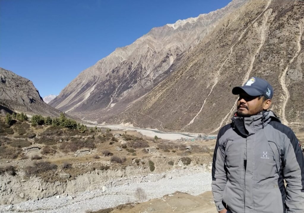
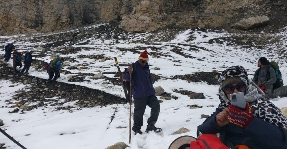
Day 3: Dharchula → Kutti Village (12,700 ft)
Duration: 4–5 hours drive
Route: Dharchula → Gala → Sirkha → Gunji → Kutti
The newly constructed BRO road into the Byans Valley makes this a smooth yet stunningly scenic journey.
Key highlights along the route:
- Gala: Dense forests and deep ravines
- Sirkha: Lush green slopes
- Gunji: A vital base for the ITBP and Army
As the valley widens, alpine terrain begins to dominate. Kutti, one of the highest inhabited villages in Kumaon, is rich in folklore. Local belief connects the area to Ravana’s meditation site dedicated to Lord Shiva.
Dinner and night halt in village homestays or camps.
Day 4: Kutti Village → Jolingkong (14,900 ft)
Duration: 30–40 minutes’ drive
This short drive is one of the most picturesque segments of the expedition. The landscape quickly transforms from lush meadows to stark glacial terrain.
Key highlights:
- A stunning glacier view emerging unexpectedly between forested slopes
- Flower-filled meadows
- First distant glimpse of Adi Kailash
Jolingkong is famous for:
- The pristine Jolingkong Lake
- Sacred temples
- Magnificent views of Adi Kailash
Overnight stay in homestays or camps at Jolingkong.
Day 5: Rest & Acclimatization at Jolingkong Base Camp
A mandatory acclimatization day to prepare for the high-altitude push to Sinla Pass.
Activities include:
- Short acclimatization hikes
- Gear preparation (crampons, trekking poles, layered clothing)
- Safety briefings
Evenings are spectacular, as the calm Jolingkong Lake mirrors the surrounding snowy peaks.
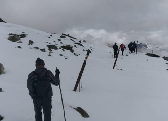
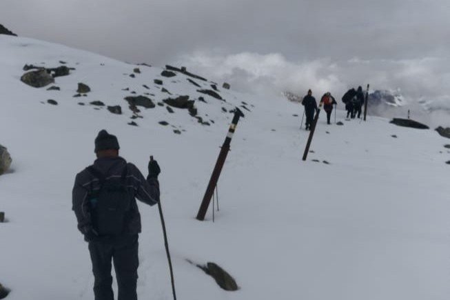
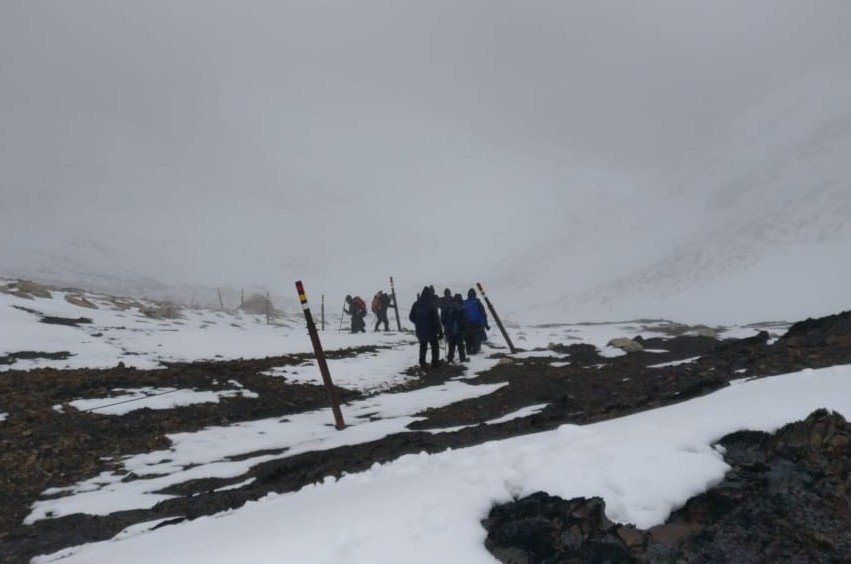
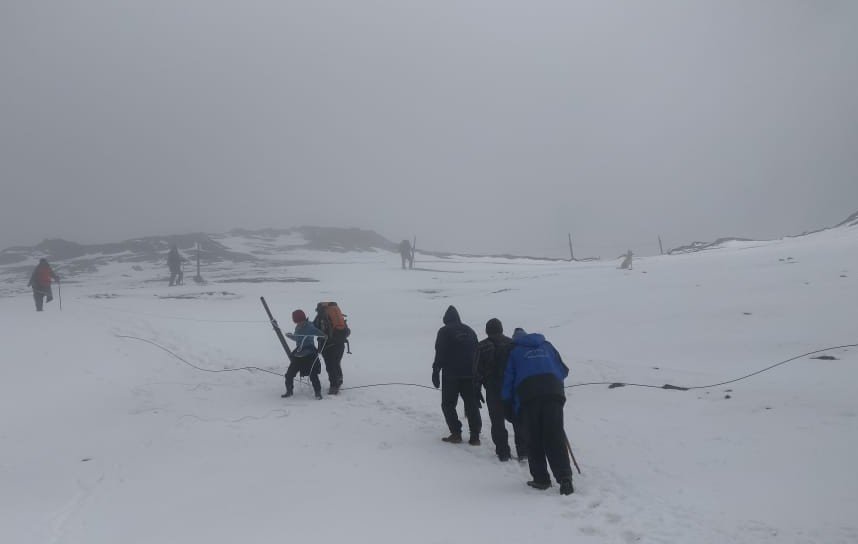
Day 6: Jolingkong → Sinla Pass (18,300 ft) → Bedang Camp
Total Duration: 9–10 hours
Ascent: 4–5 hours
Descent: 3–4 hours
This is the toughest and most rewarding day of the trek.
Ascent to Sinla Pass
The climb is steep and physically demanding, featuring:
- Knife-edge ridges
- Loose rock sections
- Glacial moraine
- Snow and icy patches
The final stretch is almost vertical over mixed rock and snow, requiring steady pacing and high stamina.
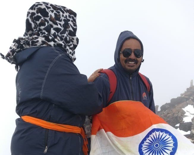
At Sinla Pass
At 18,300 ft, the pass opens up to breathtaking views:
- Close-up panorama of the Adi Kailash massif
- Snow-covered walls and ridgelines
- Vast wilderness valleys on both sides
Standing here feels both spiritual and historically significant, as the pass was once part of an ancient trade route.
Descent to Bedang
The descent requires caution due to loose gravel and snow. By afternoon, trekkers reach Bedang, an isolated meadow surrounded by towering rock walls.
Overnight in camps.
Day 7: Bedang → Dantu Village (14,200 ft)
Duration: 4–5 hours
Today’s trail passes through:
- Narrow gorges
- Mild ascents
- Wide alpine meadows
As you approach Dantu, the Panchachuli peaks—five majestic snow-covered summits—dominate the skyline.
Dantu is a beautiful traditional village set amid lush meadows.
Overnight stay at village homestays.
Day 8: Dantu Village → Drive to Dharchula
Drive Duration: 3–4 hours
The return journey follows the Dhauliganga River. The road winds through charming villages, meadows, and wooden bridges.
From Dantu, vehicles carry trekkers back to Dharchula for a relaxed evening and overnight stay at a guesthouse.
Day 9: Dharchula → Kathgodam – Departure
Duration: 8–9 hours drive
After breakfast, begin the drive back to Kathgodam. The route retraces scenic valleys, forests, and small Himalayan towns.
Upon arrival at Kathgodam, the trek concludes with unforgettable memories of the Sinla Pass expedition—an adventure of spirituality, raw nature, and high-altitude challenge.
Difficulty Level and Who Should Attempt the Trek
The Sinla Pass Trek is classified as an expedition-level and high-altitude challenge, reaching an elevation of 18,300 ft. It demands excellent physical fitness, mental resilience, and prior Himalayan trekking experience.
Safety Tips and Considerations
Trekking to Sinla Pass (18,300 ft) requires extra caution due to high altitude, unpredictable weather, and remote terrain. Following proper safety guidelines can make the journey smoother, safer, and more enjoyable.
- Hydrate Regularly to Prevent AMS
Drink water frequently—even when you don’t feel thirsty. Proper hydration helps your body adjust to high altitude and reduces the risk of Acute Mountain Sickness (AMS).
- Maintain a Slow, Steady Pace
Never rush on steep ascents. A slow pace allows better acclimatization, reduces fatigue, and keeps your breathing steady, especially in thin air zones.
- Do Not Rush the Ascent to Sinla Pass
The climb to the pass is long, vertical, and physically demanding. Climbing too fast can lead to exhaustion, breathlessness, or altitude sickness. Take regular short breaks and follow your guide’s rhythm.
- Follow Guide Instructions Strictly
Local guides understand the route, weather patterns, and hidden dangers. Always follow their commands regarding:
- When to move
- Which trail to follow
- When to stop due to weather
- How to cross tricky sections
Their experience is your biggest safety asset.
- Carry Essential Medicines and Personal First-Aid
Trekkers should carry:
- Basic first-aid kit
- AMS medicines (as prescribed)
- Pain relievers
- ORS and electrolytes
- Personal medications
Team leaders usually carry oxygen cylinders and emergency medical kits, but your own small kit is equally important.
- Respect Weather Warnings and Turn-Back Decisions
Weather in the high mountains can change suddenly. If your guide or trek leader advises to:
- delay the climb,
- wait for weather to clear, or
- return to base,
follow the instruction without hesitation. Safety is always the priority over summit attempts.