Unta Dhura Pass Adventure Trek – A Hidden Gem in the Uttarakhand Himalayas
Tucked away in the remote wilderness of Uttarakhand, the Unta Dhura Pass Trek is one of the most thrilling yet least explored high-altitude journeys in the Indian Himalayas. Rising to an impressive 5,377 meters, this pass lies deep within the Johar Valley and offers a rare trekking experience for those seeking solitude, challenge, and raw natural beauty. The route passes through untouched landscapes in the Nanda Devi Biosphere Reserve before crossing toward the Tibetan frontier—serving as both a geographical and cultural bridge between two worlds.
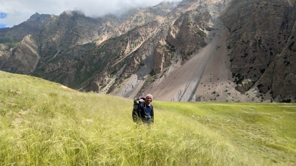
Unlike popular trekking trails, Unta Dhura remains free from the crowds of mass tourism. The journey begins in the Munsiyari region, where alpine meadows and traditional villages mark the start of ancient trade routes once linking India and Tibet. As you climb higher, the scenery shifts dramatically—from lush forests of birch and rhododendron to barren high-altitude deserts, glacial basins, and icy moraines. The trail demands both physical fitness and mental determination, with altitude, unpredictable weather, and rugged terrain testing even experienced trekkers.
The trek skirts the magnificent Nanda Devi Biosphere Reserve, a UNESCO World Heritage Site famous for its biodiversity and breathtaking mountain scenery. This natural amphitheatre is surrounded by towering Himalayan peaks, vast glaciers, and crystal-clear river valleys. Wildlife sightings can include blue sheep (bharal), the vibrant Himalayan monal, and, for the lucky few, the elusive snow leopard. The air here feels pure and energizing—untouched for centuries.
Standing atop Unta Dhura Pass is a moment of pure reward. From the summit, the west opens to the mighty peaks of the Nanda Devi range, while to the north lie the vast, windswept plateaus of the Tibetan frontier. This is more than just a view—it is a connection to an ancient trans-Himalayan route once used by traders and nomads to exchange stories, goods, and culture.
Descending toward the Tibetan side reveals a stark contrast in landscapes—arid slopes, wide valleys, and dramatic passes shaped by glaciers over millennia. This mix of terrains, combined with the remoteness of the route, makes the Unta Dhura Pass Trek a truly unique adventure.
Because of its isolation and challenging conditions, the trek requires careful planning and the guidance of experienced mountain leaders. The best time to attempt the pass is late June to early September, when snow is manageable and the high-altitude meadows are in bloom.
For those who are ready to take on the challenge, the Unta Dhura Pass Trek is more than just a journey—it is an immersion into the very heart of the Himalayas, where nature, history, and adventure come together in their purest form.
Key Highlights of the Unta Dhura Pass Trek
The Unta Dhura Pass Trek, at an impressive 5,377 meters, is a true test of endurance, fitness, and high-altitude adaptability. Those who cross this remote Himalayan pass are rewarded with unmatched views and an experience few trekkers in the world have enjoyed.
One of the trek’s biggest attractions is its spectacular mountain panoramas. From the trail and the pass, itself, trekkers can see towering peaks such as Nanda Pal (6,306 m), Nanda Gond (6,432 m), and, from the crest of Unta Dhura, stunning vistas of Kamet (7,756 m), Mukut (7,242 m), and other giants of the Nanda Devi range.
The journey also offers a rare cultural encounter with traditional Kumaoni and Garhwali Mountain life. Remote villages like Milam in the Johar Valley and Malari still preserve centuries-old customs, stone-and-wood architecture, and a deep-rooted connection to the land.
The route itself is a geographical masterpiece—shifting from dense forests and flower-filled alpine meadows to stark glacial moraines and barren high-altitude deserts. This variety of landscapes, combined with the trek’s isolation, makes the Unta Dhura Pass a once-in-a-lifetime adventure for experienced trekkers and true nature lovers.
An Unplanned Adventure via Girthi Village
Day 1: Arrival in Munsiyari (Altitude – 2,200 m)
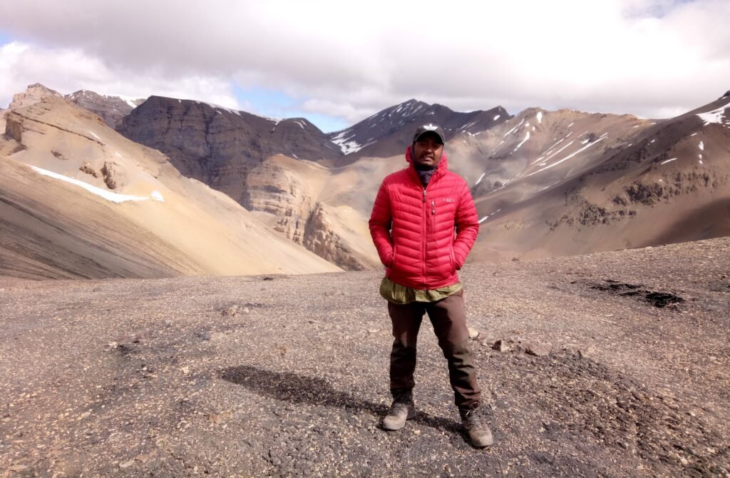
On 27th July 2021, my friend Vijay Routala and I met in the scenic hill town of Munsiyari, eager to begin our long-awaited journey to the Unta Dhura Pass. Months of planning had led to this moment, and standing at the gateway to the Johar Valley, the excitement was almost tangible. Our trek was set to start the very next morning, 28th July.
Often called the “Little Kashmir of Uttarakhand”, Munsiyari is a stunning base camp surrounded by the mighty Panchachuli massif and other snow-clad Himalayan peaks. Sunrise and sunset here are nothing short of magical, with golden and crimson hues sweeping across the mountains.
The town is deeply connected to Kumaoni culture, home to the warm and welcoming Johari Shauka community. They are known for preserving age-old traditions, folk music, and festivals, as well as their skill in wool weaving and wood carving—crafts that reflect generations of heritage.
For food lovers, Munsiyari offers authentic Kumaoni cuisine—flavorsome dishes like Bhatt ki Churkani, Aloo ke Gutke, and Madua Roti, often served with fresh vegetables and aromatic local spices.
With its blend of breathtaking landscapes, rich traditions, and delicious food, Munsiyari was the perfect place to begin our expedition—a starting point that set the tone for the remote and rugged adventure to come.
Day 2: Munsiyari to Nahar Devi Campsite (Altitude – 2,800 m)
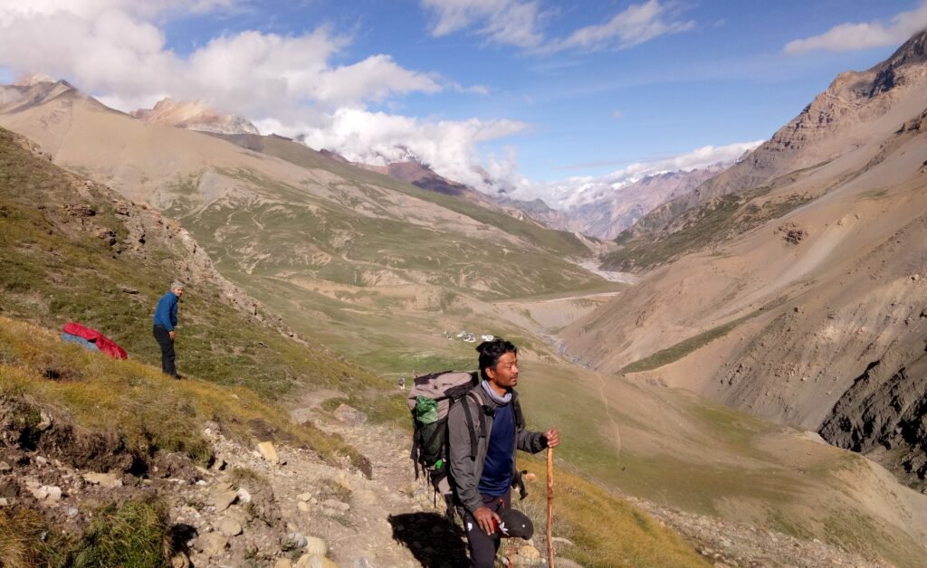
On the morning of 28th July 2021, we set off on the first leg of our Unta Dhura Pass adventure. From Munsiyari, a two-hour drive took us to Rargari, along winding mountain roads scented with fresh pine and offering fleeting views of the Panchachuli peaks slowly fading into the distance.
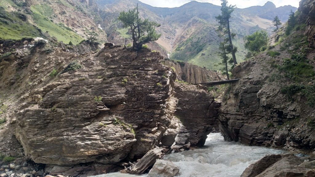
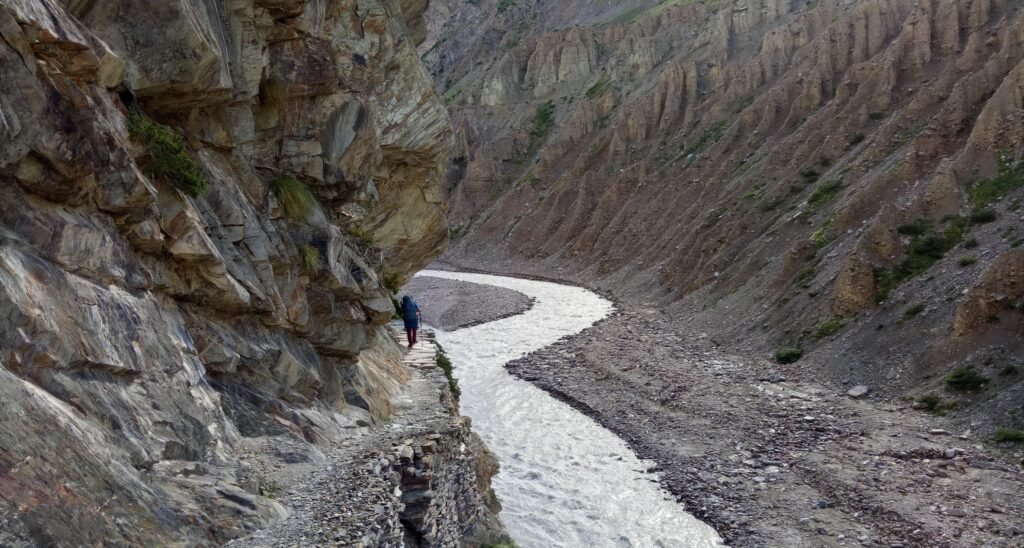
From the Rargari Roadhead, the real trek began. The trail led us through wild, unspoiled terrain to the Nahar Devi Campsite—a natural amphitheatre framed by two towering rock walls. On one side, the Gori Ganga River thundered past, its icy waters rushing down from faraway glaciers. On the other, steep cliffs soared skyward, their surfaces streaked with subtle shades of mineral colour.
The steady roar of the river blended with the crisp mountain breeze, creating a rare mix of energy and calm. At sunrise and sunset, the cliffs caught the light and glowed golden, transforming the campsite into a photographer’s dream.
For us, Nahar Devi was more than just a place to pitch our tents—it was our first deep step into the Himalayan wilderness. Surrounded by raw beauty and the sound of rushing water, we felt the pull of the high, untamed trails that lay ahead on our journey to Unta Dhura Pass.
Day 3: Nahar Devi Camp to Rilkot Village (Altitude – 3,130 m)
The trek from Nahar Devi Camp to Rilkot Village is a beautiful mix of contrasts—sections of newly built motorable road blending into stretches of scenic meadow trails. As we walked, the valley slowly widened, revealing sweeping views of the Gori Ganga River far below and the surrounding snow-capped Himalayan peaks.
After about three hours on foot, we reached Laspa Village, a serene hamlet draped in lush green meadows that looked as though they had been painted into the landscape. Here, wildflowers dotted the grass, and the crisp mountain air carried the scent of pine and alpine blooms.
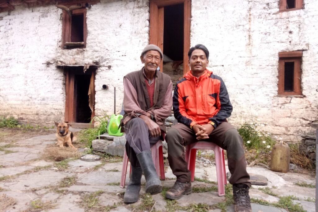
By late afternoon, we arrived at Rilkot, a remote Himalayan settlement with just a few stone houses. It is home to an Indo-Tibetan Border Police (ITBP) transit camp and only four to five Bhotiya families who live here for six months of the year. When the heavy snow arrives in October, they migrate to lower valleys to escape the harsh winter.
The Bhotiya people are known for their resilience and cultural heritage, once thriving through trade with Tibet until the 1962 Indo-China War closed the border. Life here is simple yet profound—stone homes standing against towering peaks, crystal-clear mountain streams flowing through the village, and a silence so pure it feels timeless.
For trekkers, Rilkot is more than just a stopover—it is a rare window into a way of life that is slowly disappearing from the high Himalayas.
Day 4: Rilkot Village to Milam Village (Altitude – 3,400 m) Base Camp for Unta Dhura Pass
Leaving Rilkot Village, the trail meanders through a mix of newly built road sections and lush alpine meadows in the Gori Ganga Valley. Beyond Rilkot, the valley widens dramatically, unveiling sweeping high-altitude pastures and grand Himalayan vistas.
The route passes through the picturesque settlements of Burfu and Bilju, where trekkers are treated to stunning close-up views of the Nanda Devi Twin Peaks, the Panchu Glacier Valley, the Milam Glacier, and the towering Hardeol Peak. These villages, with their traditional stone houses and terraced fields, offer a glimpse into life in one of the most remote corners of Kumaon.
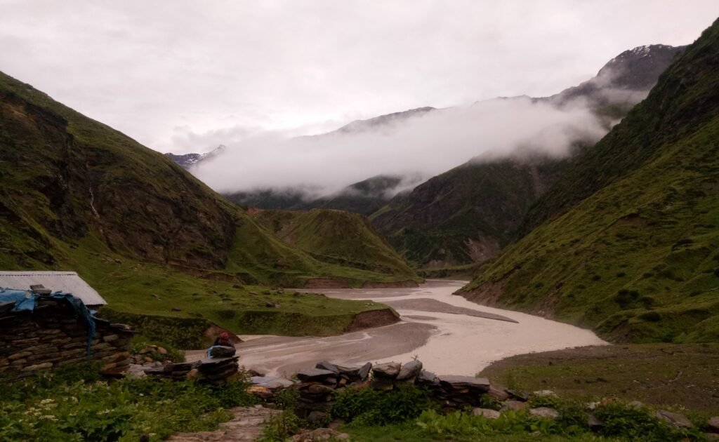
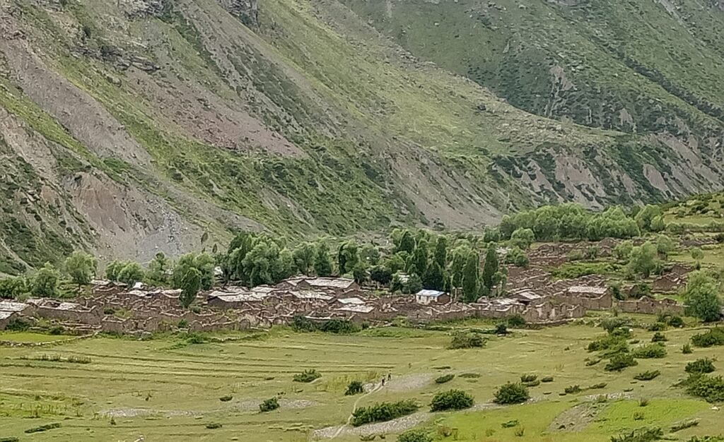
A sturdy bridge spans the Goinga River, marking the final stretch to Milam Village. Spread across a vast open plain on the banks of the Gori Ganga, Milam is fed directly by the Milam Glacier, which also serves as the starting point of another celebrated Himalayan trek.
Milam’s legacy runs deep. It is the birthplace of Pandit Nain Singh Rawat, the legendary 19th-century surveyor-explorer who mapped and documented much of Tibet during British rule. Before the 1962 Indo-China War, Milam thrived as one of the largest villages in the region, with over 400 Bhotiya families. It was a bustling trade hub where caravans from Tibet, the Johar Valley, and Kumaon exchanged wool, salt, grains, and spices.
Today, only a handful of families remain, cultivating medicinal herbs and keeping alive their Bhotiya heritage. Milam’s charm lies in its vast, windswept plains, the ever-present roar of the Gori Ganga, and the haunting sense of history that lingers in the shadow of its towering peaks. For trekkers, it is an unforgettable base camp for both the Unta Dhura Pass and Milam Glacier expeditions.
Day 5: Milam Village to Milam Dung Camp (Altitude – 3,760 m)
Today’s journey takes us beyond the last inhabited settlement of the valley, Milam Village, to the picturesque Milam Dung Camp—our first night halt in the uninhabited highlands. The trail begins with a steady climb into the right-hand valley, following the right bank of the Goinga River, a glacial stream fed by multiple meltwater channels.
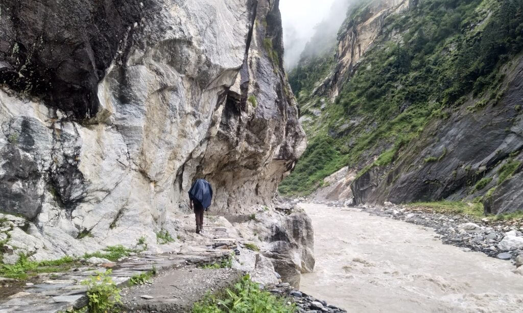
The first hour is a narrow path scattered with scree and pebbles, hugging the edge of a deep gorge. Here, echoes of the past emerge—old wooden bridges ingeniously anchored between steep rock faces, once essential for local travel and the thriving trans-Himalayan trade.
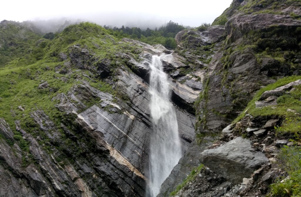
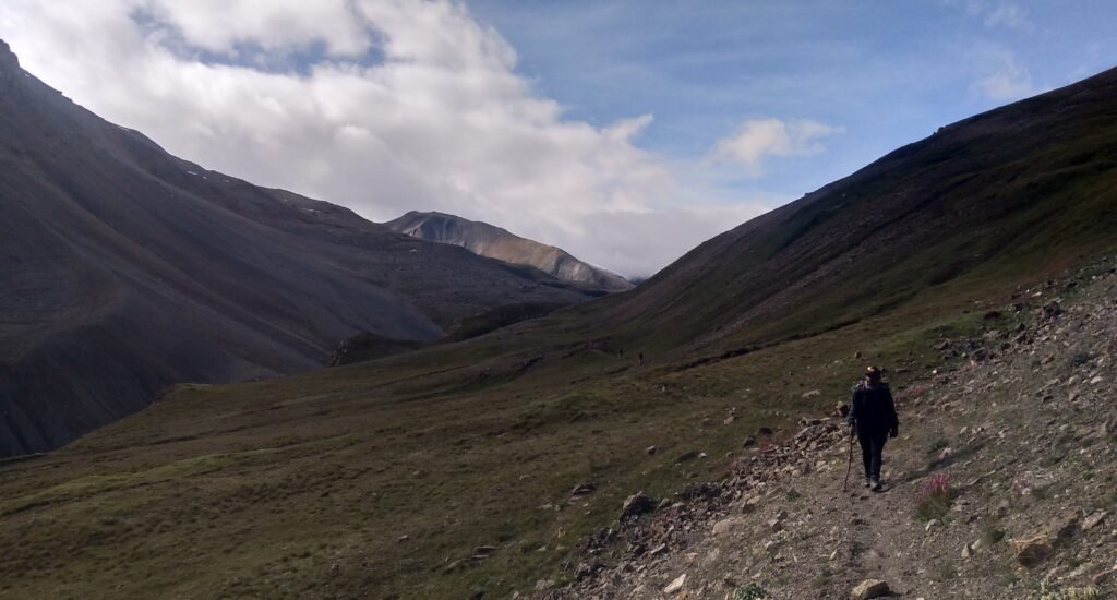
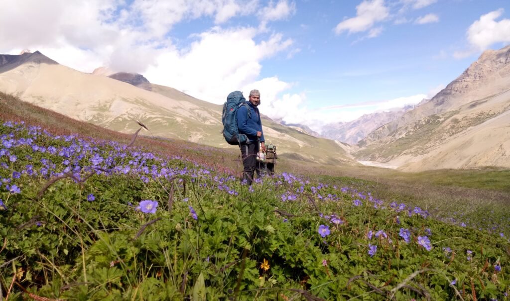
After about two hours, the valley opens dramatically, revealing a breathtaking expanse untouched by human activity. Vast green meadows unfurl toward the horizon, dotted with bursts of pink, blue, and yellow wildflowers. Alpine pastures blend into moorlands, and the crisp mountain breeze carries the earthy scent of grass and wild blooms. In the distance, snow-clad peaks stand watch over the serene landscape, while glacial streams weave through the fields, their gentle murmur adding to the sense of tranquillity.
The final two hours of the day’s trek are a gentle walk across rolling meadows, each step revealing new perspectives of the surrounding mountains. By mid-afternoon, we arrive at Dung Camp—a stunning high-altitude campsite set in the heart of a wildflower-filled meadow, with uninterrupted 360-degree mountain views.
Here, the air feels cleaner, the silence deeper, and the connection to nature more profound. It is the perfect place to rest, acclimatize, and absorb the untouched beauty of the upper Himalayas before venturing deeper toward the challenging heights of the Unta Dhura Pass.
Day 6: Dung Camp to Bumlash Camp (Altitude – 4,200 m)
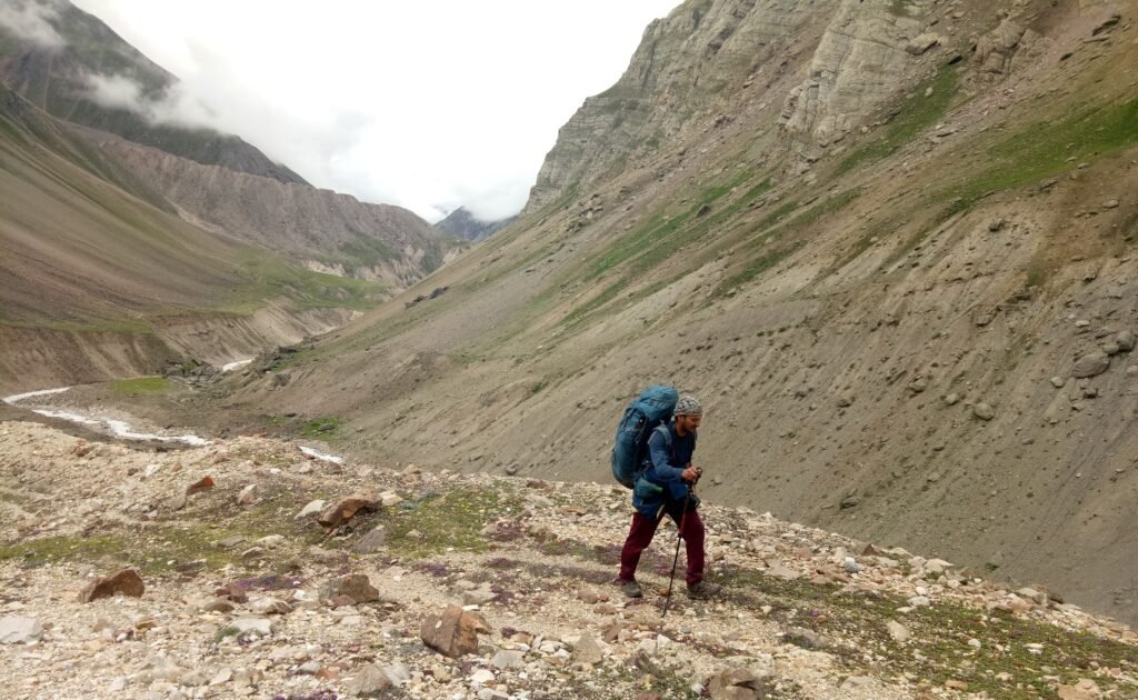
Leaving Dung Camp, the trail ahead feels more remote and wild, with fewer signs of human passage. This section was once part of the historic Indo-Tibet trade route, but years of disuse and natural erosion have left it broken in places. Today, it is traversed only by the Indo-Tibetan Border Police (ITBP) during patrols and supply runs.
The initial stretch is a gradual climb over a mix of alpine meadows and light moraine, occasionally interrupted by rocky patches. The silence here is striking—broken only by the distant rush of the river below and the crunch of boots on gravel. As the trail rises, the air turns cooler and thinner, and the surrounding peaks appear to edge closer, filling the horizon with their snow-draped grandeur.
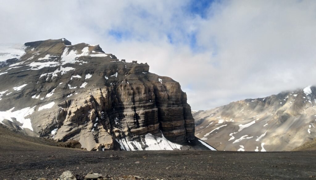
Several hours into the trek, the route bends toward the Bumlash Glacier, where our campsite for the night awaits. The Bumlash Camp is set near the glacier’s snout, in a high, open basin surrounded by a breathtaking display of Himalayan majesty. Towering above are Nanda Pal and Nanda Gond, their snowbound slopes catching the light in dazzling contrast to the dark rock faces below. The combination of ice, rock, and endless blue sky creates a panorama that feels both dramatic and serene.
Bumlash, while stunning, is also an exposed campsite, often battered by strong afternoon winds. Reaching early is essential to pitch tents securely before the gusts pick up. As night falls, the wind eases, and the stillness is broken only by the distant creaks and whispers of the glacier.
Spending the night here, at over 4,200 meters, in the shadow of Himalayan giants, offers a rare and unforgettable experience—one that blends isolation, raw beauty, and the quiet power of the high mountains.
Day 7: Bumlash Camp to Gangpani Camp via Unta Dhura Pass (Altitude – 5,377 m)
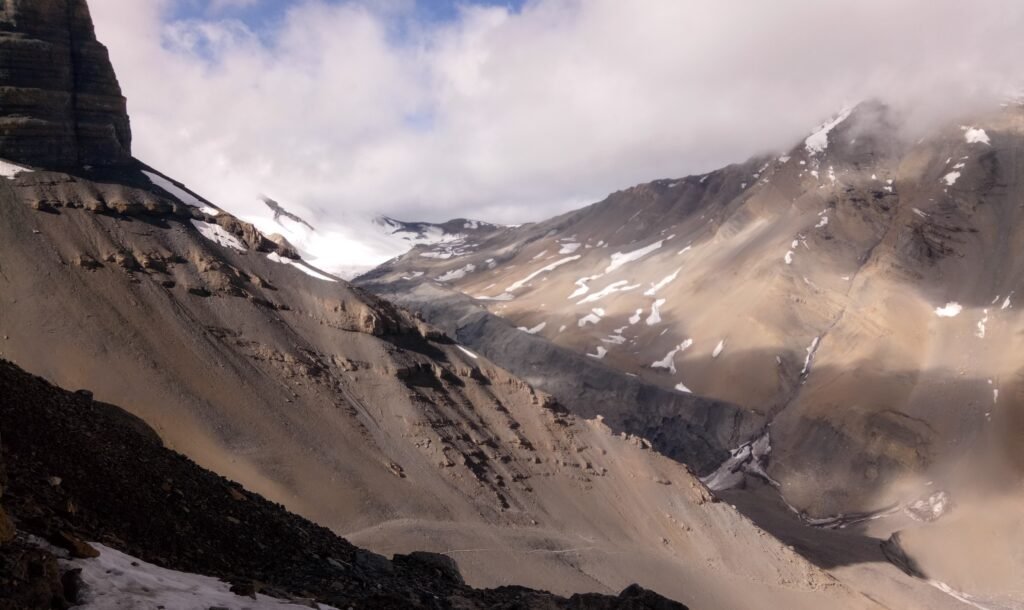
We start early from Bumlash Camp, carrying packed lunches for what will be one of the longest and most challenging days of the trek. The climb toward Unta Dhura Pass begins steeply, without a defined trail—navigation depends on spotting cairns (stone markers) placed by the Indo-Tibetan Border Police.
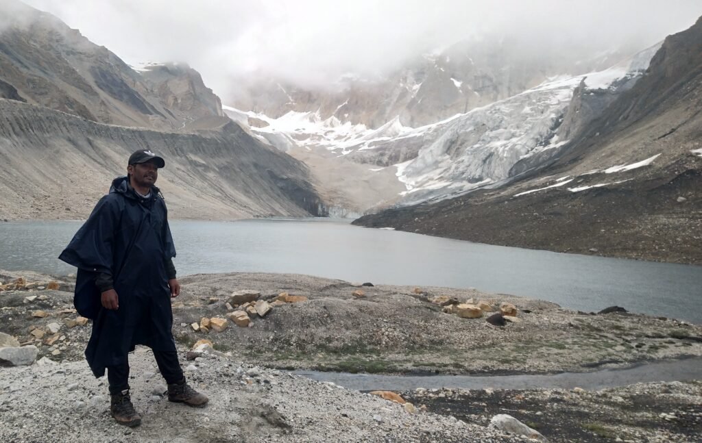
After an hour of ascent, the route reveals a breathtaking sight—Pari Taal, a vast high-altitude freshwater lake at 4,500 meters, fed directly by a massive glacier. Icebergs drift slowly across its deep blue surface, while the still waters reflect the surrounding Himalayan peaks in perfect clarity. This is the last reliable water source before the pass, making it an essential stop to refill bottles.
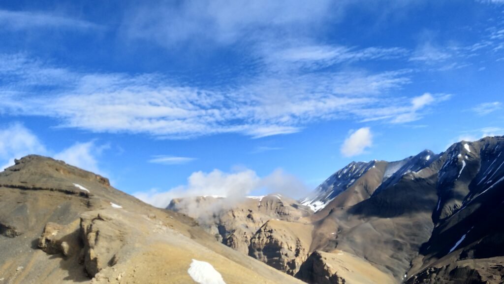
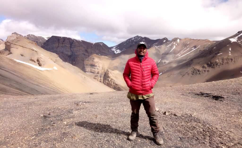
From Pari Taal, the trail steepens sharply for a three-hour push to the crest of Unta Dhura Pass. At 5,377 meters, the pass offers a sweeping panorama—towards the north lies the dry, rugged expanse of the Tibetan plateau, while to the south, the snowbound giants of the Milam Valley dominate the skyline. Both the Milam and Malari Valleys are visible from here, along with several prominent peaks of the Nanda Devi range.
After taking in the views and capturing photographs, we begin a one-hour descent toward Jayanti Dhura, staying to the right to reach Gangpani Camp. This spot holds deep historical significance—it is a tri-junction where routes once converged from Malari, Milam, and Kungari Bingari La Pass in Tibet. Before the 1962 Indo-China War, it served as a bustling trade meeting point for merchants from Kumaon, Garhwal, and Tibet, who would travel together into Tibet via Jayanti Dhura Pass (5,670 m), crossing the Nachgoan Glacier before ascending Kungari Bingari La (5,600 m).
Today, the ruined remains of the old Martoliya Hotel still stand here—a silent reminder of the region’s once-thriving trans-Himalayan trade.
Day 8: Gangpani Camp to Topidhunga (Altitude – 4,000 m)
Today’s journey takes us on a gradual descent from Gangpani Camp toward Topidhunga, following a glacial stream through an open valley of lush summer meadows. Along the way, the ridgelines of Kyeo La and Bayalcha La rise in the distance, their sharp silhouettes standing boldly against the horizon.
Between Milam Village and Topidhunga, vegetation becomes sparse. The landscape is mostly dry, with wide, open meadows surrounded by rocky slopes and barren terrain that resemble a moon-like surface. The feeling of isolation here is profound—an endless expanse framed by distant, snow-clad peaks, where the silence is broken only by the soft rush of the glacial stream.
Topidhunga Camp itself is a sprawling alpine meadow cradled in the lap of the Nanda Series mountains. Just beside the campsite, clear glacial streams wind gently through the grasslands, their waters feeding the fertile summer pastures. During the monsoon, this meadow bursts with life as shepherds arrive with enormous flocks—sometimes numbering over a thousand goats—to graze in these high-altitude grasslands.
The camp takes its name from a distinctive landmark—a single massive boulder (“Dhunga” in the local language) that sits prominently in the center of the meadow, as if guarding the valley.
From Topidhunga, two main routes lead to Malari Village. One is via the 52 Bends and Sumana, a track often used by ITBP personnel and shepherds. The other descends through Girthi Village, following the Girthi River deep into the valley.
More than just a scenic campsite, Topidhunga serves as an important junction between valleys—a place where the high mountain trails begin to merge into the borderland routes, carrying with them the timeless rhythms of trade, migration, and seasonal movement.
Day 9–10: Into the Unknown – Topidhunga to Malari via Girthi Village
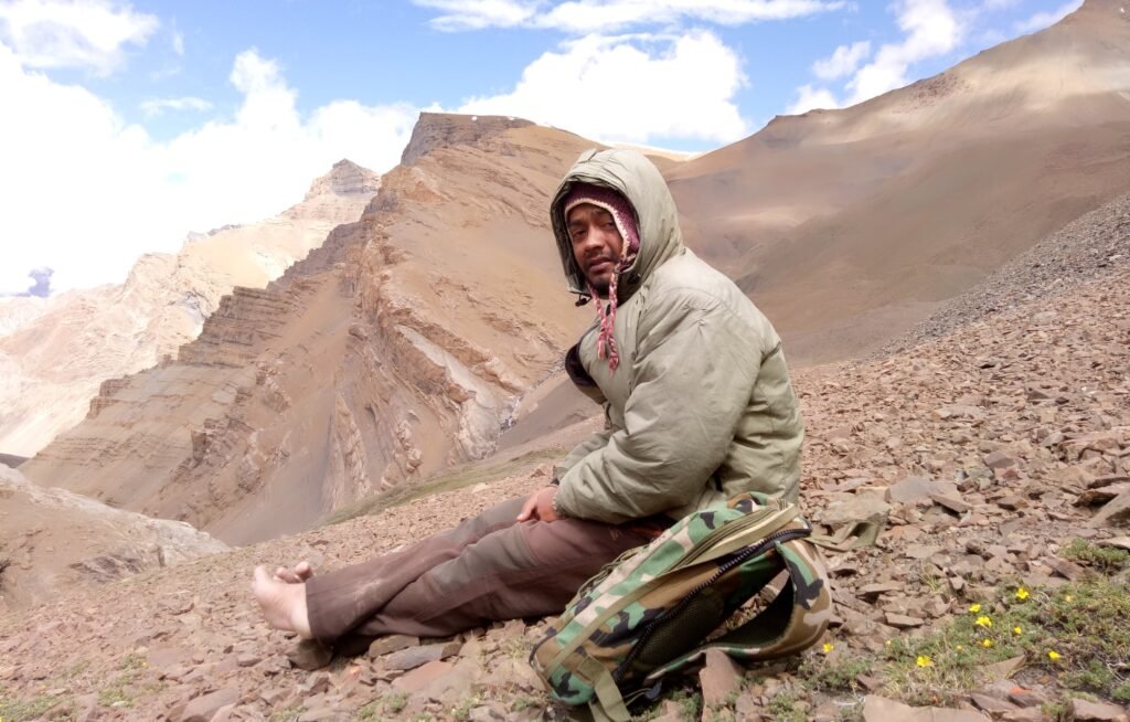
The night before at Topidhunga Camp was calm, the air still and crisp. Yet, inside our tents, my friend Vijay Routela—a seasoned trekker—and I were restless. We had a choice: take the familiar trail to Malari via the 52 Bends, or attempt something few had tried in decades—crossing into the forgotten Girthi Valley, abandoned since the 1962 Indo-China War. Curiosity won.
At 5:00 AM, under the soft light of dawn, we packed lightly: a few dry fruits, some chocolates, and four puris between us. There was no trail—only a wide, silent valley where instinct was our only compass. The terrain alternated between grassy stretches and rocky outcrops, each step leading us deeper into the unknown.
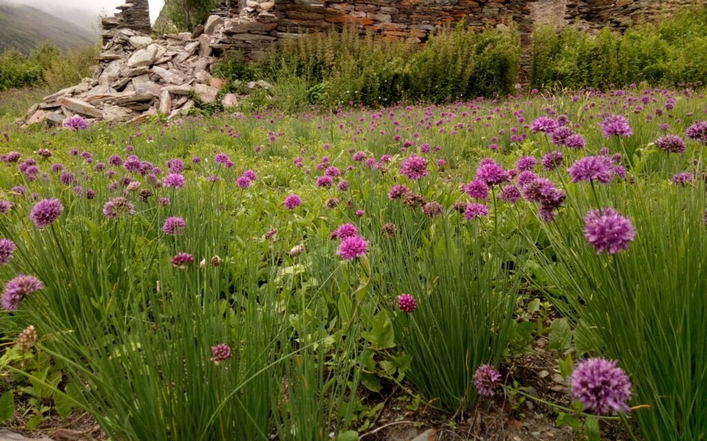
After nearly four hours, shapes began to take form on the horizon—the skeletal remains of Girthi Village. Roofless stone houses stood in solemn rows, their walls scarred by time. Wooden bridges lay broken over dry streambeds, and abandoned fields whispered of lives once lived here. The silence was heavy, as if the mountains themselves remembered the day the villagers left, never to return.
We rested briefly, then pushed onward. The day turned into a punishing march—endless ascents and descents between 3,200 and 3,500 meters. Hours passed with no sign of water. The sun dipped behind the peaks, and fatigue crept into our bones. Just as doubt began to cloud our resolve, a faint sound reached us—the gurgle of running water.
Following it, we reached a narrow stream tucked beside a small cave. Relief washed over us. We lit a small fire, warmed ourselves, and crawled inside. The cold stone floor felt softer than any bed. Sleep came quickly, wrapping us in a cocoon of exhaustion and contentment.
Morning revealed a dense forest ahead, broken by boulder fields and braided streams. Navigating this maze took hours. Finally, the trees parted to reveal the Girthi River, its grey-green waters rushing towards the valley floor. We followed its banks until a motorable bridge appeared—a bridge that marked the return to civilization.
By evening, on 15 August 2021, we walked into Malari Village—hungry, sore, and dusty, yet carrying with us a story etched into memory. We had crossed a forgotten valley, touched its silent history, and returned with a piece of it in our hearts.
Challenges of the Unta Dhura Pass Trek
The Unta Dhura Pass Trek is not for the faint-hearted. It is an expedition that demands more than just fitness — it calls for grit, preparation, and the ability to adapt when the mountains test your limits. From the very first day, the journey pushes trekkers beyond comfort zones, combining physical strain with the mental challenges of isolation and uncertainty.
- Steep and Relentless Ascents –
The trek involves repeated climbs over steep gradients, where every step feels heavier at high altitude. Unlike moderate treks that offer gradual inclines, Unta Dhura’s ascents can be abrupt, forcing your legs and lungs into overdrive. The lack of oxygen above 4,000 meters slows the pace, and even seasoned trekkers find themselves stopping frequently to catch their breath.
- High-Altitude Challenges –
With much of the route above 4,000 meters and the pass itself at 5,377 meters, altitude is a constant factor. The thin, crisp air makes breathing harder and increases the risk of Acute Mountain Sickness (AMS). Fatigue sets in faster, and tasks as simple as packing your bag or pitching a tent can leave you winded. Proper acclimatization days and hydration are non-negotiable here.
- Unpredictable Himalayan Weather –
In the high Himalayas, weather changes with little warning. A clear morning can quickly dissolve into snow flurries, sleet, or fierce winds. Dense clouds can reduce visibility to mere meters, making navigation tricky and disorienting. At the pass, wind speeds can be brutal in the afternoon, so timing your climb is critical. This unpredictability demands both caution and flexibility in daily plans.
- Absence of Established Trails –
Perhaps the most defining challenge of the Unta Dhura Pass is the lack of a defined path. There are no signboards, no marked routes, and no tea houses to act as checkpoints. The trail weaves through diverse terrain — emerald alpine meadows, loose glacial moraine, boulder fields, and barren highlands — where the only guides are scattered cairns left by shepherds or the Indo-Tibetan Border Police (ITBP). In many stretches, you are forging your own way, relying on maps, GPS, or sheer instinct.
- Isolation and Remoteness –
This trek lies in one of the most remote corners of Uttarakhand. Rescue or evacuation is not a quick option, and mobile connectivity is virtually non-existent for most of the journey. Once you leave the last inhabited village, human presence becomes rare, replaced by the sound of wind, the gurgle of glacial streams, and the occasional sighting of wildlife. This remoteness is both its beauty and its challenge — it heightens the sense of vulnerability while deepening the sense of adventure.
- The Reward Beyond the Hardship –
Yet, it is precisely these challenges that make the Unta Dhura Pass a treasure for true explorers. The solitude is profound — there are moments when you feel like the only human for miles. The landscapes shift from lush meadows to shimmering ice fields, culminating in the awe of standing atop a high pass with panoramic views stretching into Tibet and across the Nanda Devi ranges. Few modern trekkers have set foot here, making the sense of accomplishment unmatched.
In the end, Unta Dhura is not just a physical journey but a test of patience, resilience, and humility before nature’s grandeur. It strips away the distractions of the modern world and leaves you face-to-face with raw, unaltered wilderness. For those willing to take on its challenges, it offers not just a trek, but a once-in-a-lifetime Himalayan odyssey.
Tips for Trekking to Unta Dhura Pass
The Unta Dhura Pass Trek is a rare and challenging adventure deep in Uttarakhand’s Himalayan frontier. Its location — near the Indo-Tibetan border — means it is not only remote but also highly regulated. To make the most of this expedition while ensuring safety, preparation is key.
- Secure Your Inner Line Permit Early
Because the trek lies in a sensitive border zone, a special Inner Line Permit (ILP) is mandatory. It will be checked at multiple security posts along the route. Applying for this permit requires valid government-issued identification, recent passport-sized photographs, and sometimes pre-approval from district or military authorities. Begin the application process well in advance — at least two to three weeks before your planned departure — to avoid last-minute delays.
- Travel with Experienced Guides
In the Unta Dhura region, self-guided trekking is strongly discouraged. The route has no permanent markers, and conditions change rapidly due to weather, landslides, or river swelling. Local guides and porters not only know the safest paths through glacial moraines, scree slopes, and high-altitude meadows, but they are also well-versed in local regulations and can facilitate interactions with security personnel. Their knowledge can mean the difference between a smooth trek and a dangerous detour.
- Prepare for Harsh and Unpredictable Conditions
Expect a mix of steep ascents, thin air, and sudden weather shifts. Daytime sunshine can quickly give way to snow or sleet, even in summer. Temperatures at night can plunge well below zero, especially near the pass at 5,377 meters. Carry:
- Layered clothing for quick adaptation to temperature changes.
- High-quality trekking boots with strong ankle support.
- A sleeping bag rated for sub-zero temperatures and a reliable sleeping mat.
- Waterproof gear to protect against sudden downpours or snow flurries.
- Equip Yourself for Navigation
While GPS devices and detailed topographic maps are valuable tools, your guide’s local expertise remains irreplaceable. In poor visibility or featureless terrain, electronic navigation can be tricky, so always carry a compass and know the basics of route-finding.
- Food and Water Management
Once you leave the last inhabited settlement, there are no shops, lodges, or resupply points. Carry extra rations of dry fruits, energy bars, and ready-to-eat meals. While streams and glacial meltwater are common along the trail, always treat water before drinking using purification tablets, filters, or boiling.
- Acclimatization and Physical Fitness
The trek demands endurance and altitude adaptation. Spend at least a day acclimatizing at intermediate elevations before crossing the pass. Training beforehand — focusing on cardio, leg strength, and stamina — will make the high-altitude climbs more manageable.